- Coded, tested, and debugged FPGA verification modules.
- Translated verification requirements into sequence diagrams, outlining specific OSVVM calls and messages between verification components.
- Adhered to strict coding standards and documentation requirements in preparation for an ICDR (Internal Critical Design Review).

Wireless Localization with Digital Twins and Beam-Delay Profiles
UCSB Wireless Communications and Sensornets Laboratory (WCSL) · Advisor: Prof. Upamanyu Madhow
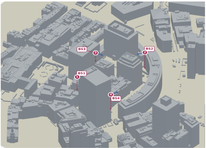
We estimate a transmitter’s position from wireless channels observed at multiple base stations. A site-specific digital twin generates simulated signals, which we turn into beam–delay fingerprints and use to train a localization model.
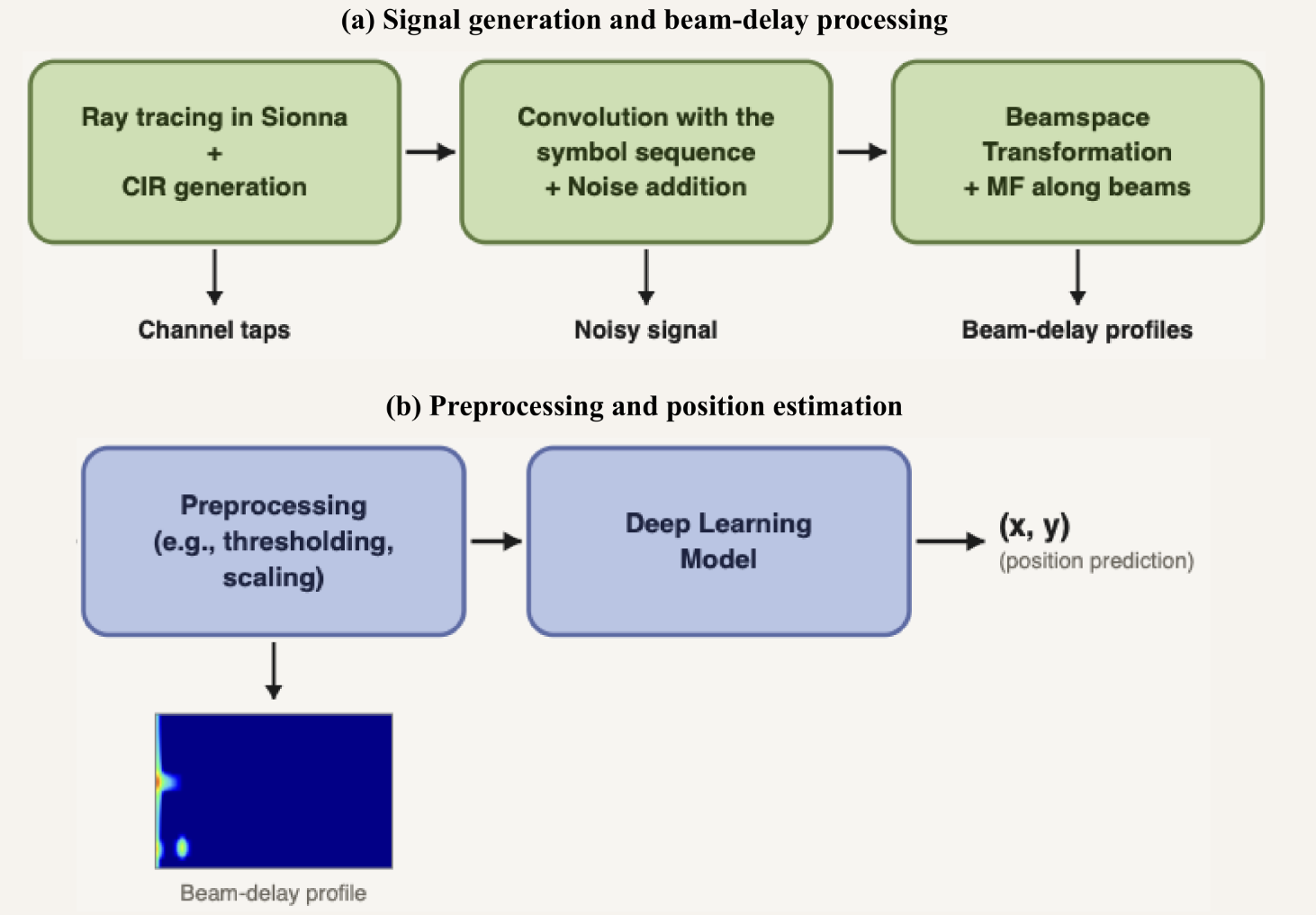
The localization pipeline
- Build the digital scene: represent the buildings and their material properties.
- Simulate propagation: use NVIDIA Sionna for ray tracing to obtain paths with complex coefficients, delays, and directions.
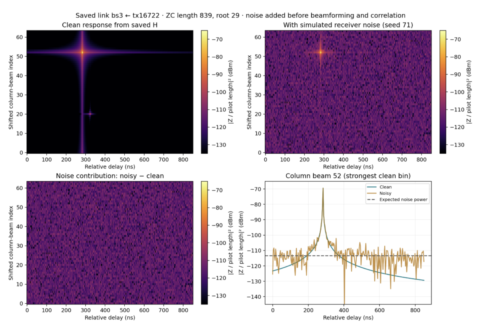
- Model the receiver: synthesize receive-array channels, add receiver noise to simulated pilot signals, then apply spatial beamforming and pilot correlation.
- Form fingerprints: represent each link’s received signal across beam and relative-delay dimensions.
- Estimate position: normalize and combine fingerprints from multiple base stations, then train a CNN to predict horizontal position.
Selected Contributions
Robustness to environmental changes. I developed and evaluated synthetic attenuation that changes simulated propagation paths before regenerating the receiver fingerprints. Initial experiments that randomly deleted line-of-sight paths gave limited benefits or worsened performance. I then grouped paths by their departure directions and attenuated or deleted paths within a three-dimensional cone together. Inspired by earlier work perturbing antenna CSI, this method acts on correlated path groups before coherent summation. It can affect line-of-sight and reflected paths across multiple base stations, approximating correlated blockage without physically simulating a new obstruction.
Building-height corrections. I traced implausible building heights to default assignments in the Geo2SigMap scene-generation process, then integrated Overture building and building-part heights through footprint matching. One illustrated footprint changed from a 17.5 m default to 175.7 m. I presented the investigation to Duke’s FuNCtions Lab and opened a pull request at their request.
Results and scope
- Cambridge localization: 4.20 m mean error on a separate test set with receiver noise enabled.
- Noiseless car-obstruction test: grouped synthetic attenuation reduced mean localization error by 15%.